Monday 19 October 2009

November Walks from Slaidburn

The walks next month will be from the well known village of Slaidburn and will take place on
Saturday 14th November
There will be three walks;
Please note that Slaidburn like the rest of the country has had a lot of rain, which is lying on the clay and peat soil. On 2nd November the ground was very, very wet. Please ensure that footwear is in good condition and wear gaiters if you have them

Slaidburn is a village and civil parish within the Ribble Valley district of Lancashire, England.

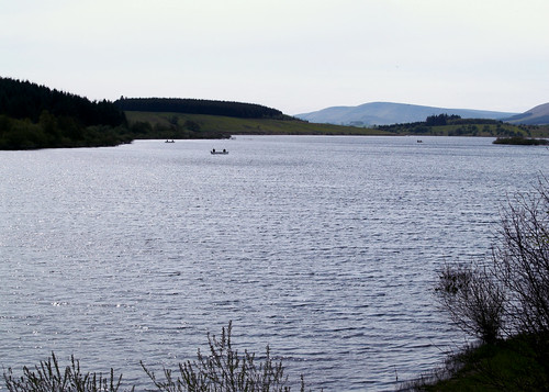
Historically a part of the West Riding of Yorkshire, Slaidburn lies near the head of the River Hodder, within the Forest of Bowland, an Area of Outstanding National Beauty.

The civil parish of Slaidburn shares a parish council with Easington, a rural parish to the north of Slaidburn.[2]

Farming is still a major employer, but the area attracts tourists – for walking in particular.

The parish church of St Andrew has a superb Jacobean screen and a fine Georgian pulpit. The brass band composer William Rimmer (1862-1936) composed the now-popular march, named Slaidburn after the village, for the Slaidburn Silver Band. A new village hall has opened to much fanfare and is being well used and of course we all know the hostelry 'Hark to the Bounty' the venue for many of our Christmas Meals, the last time being in January 2007 (but not this year).

For more information about Slaidburn's historic buildings and heritage, look at this description but note this is not one of the walks.

A Walk from Slaidburn

Leader: Jenny Matthias
Distance 11.5 miles
Total Ascent/descent: 1200ft


Although this walk is not difficult it is long and a good pace will need to be maintained because of the short day.

We will leave the car park and walk up the hill to the war memorial turning right along the Bentham Road. Over the bridge we take a footpath on the right across the fields to a farm road and cross the River Hodder up to Hammerton Hall Farm. We continue along the track to Black House Farm then we follow the farm road to Hole House Lane. Joining the road we see St James Church (rebuilt after the drowning of Stocks village for the reservoir). We follow the road for about a third of a mile. We have views of Stocks Reservoir.

At the car park we pick up a circular route around the reservoir, firstly through woods then rising to moorland passed New House (a ruin!) onto another farm track for Catlow Farm. We leave this briefly to take a path by the brook, Parks Clough Beck. Rejoining the farm road we follow it to the Bentham Road. Here there is about a mile and a half of road walking, mostly uphill! Finding a path again we head in a SE direction towards Croasdale Farm. A little way along the farm road we take the footpath across the fields with at least five stiles, sheep and cows until once more we reach the Bentham Road near the Bridge and we arrive back in Slaidburn.

B Walk from Slaidburn


Leader: Beverley Kelly (due to the unfortunate indisposition of Les Gibson)
Distance: 8 miles approx
Total Ascent/descent: 1140ft

Route Map:


We have a short steep climb out of the village with a good view of the valley. As we come over the brow of the hill, we catch sight of Easington Fell, then Broadhead Farm.


From hear it is a steady but not steep climb upwards through Skelshaw and then Fell Side, which seems to be shooting hospitality Farm with some unusual vehicles for traversing the landscape. We shall not be needing them.

The track continue around the side of Standridge Hill heading towards ‘Old Ned’ changing to a peaty walk on the last leg.

At ‘Old Ned’ we can survey and recognise a large variety of landmarks. Our way back is across open moorland to a faint track which opens up to an overgrown cart track across the moor passing a tarn. This may very well be very wet and boggy. As we continue downhill our views change and even in very heavy rain we had dramatic views


We head towards Newton and a fairly level walk, partly alongside the river and then past Dunnow Hall, which was recently renovated and back to Slaidburn.

Newton or New Town existed over 1000 years ago having been created by people moving down from higher settlements, such as Beatrix, requiring more water and a corn mill.


If the river is still flooded then we will walk along the minor road past Easington and back over Whiteholme to Slaidburn


Thursday 15 October 2009

C Walk from Slaidburn

Walk Leader: Terry Simmons
Distance: 6 miles
Total Ascent/Descent: 502 ft
Route map:
'C' route is the purple one. Click on map to enlarge


We depart from the cafe near the car park after morning coffee and go through the village, passing the 'Hark to the Bounty' Pub, an old coaching inn. We carry along Back Lane, then right through woodland, crossing over Tenter Hill, through the farm of Myttons, then on towards Pains Hill Farm. Next we walk through Formby resident John Moores son's farm and the newly named Parrock Head Hall, down to Crawshaw's Farm and after 20 mins approx arriving in the village of Newton. Our route back to Slaidburn follows the contours of the river Hodder in time for a leasurely afternoon refreshments.


Hark to Bounty - The Hark to Bounty is one of the oldest surviving buildings in the village, dating back to the late 16th century. From about 1590 it was the site of the Halmote Court for the Forest of Bowland - the local court at which minor disputes were settled. The Inn was originally known as the 'Dog Inn'. It is said that the present name was given by the Rev Henry Wigglesworth in the mid-19th century. One day he heard the distinctive sound of his favoured dog barking among a pack of hounds, and exclaimed to his companions, "Hark to Bounty".

Photos taken on the walks at Betws-y-Coed