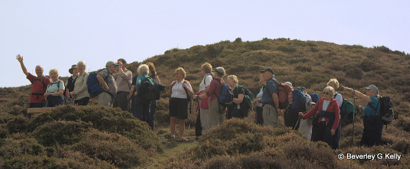
Welcome to the Holy Trinity Fell Walking Club in the village of Formby!
Get your boots on and join in the fun.
Walking on the Second Saturday March to November
Three Graded and Tested Walks - Coach Transport from Formby Village
Our next walk will be to the Yorkshire village of Malham and will be on;
Saturday 8th May 2010
The coach will leave the short stay car parkto the south of Formby village at 0800hrs prompt.
Pre-booking is essential.
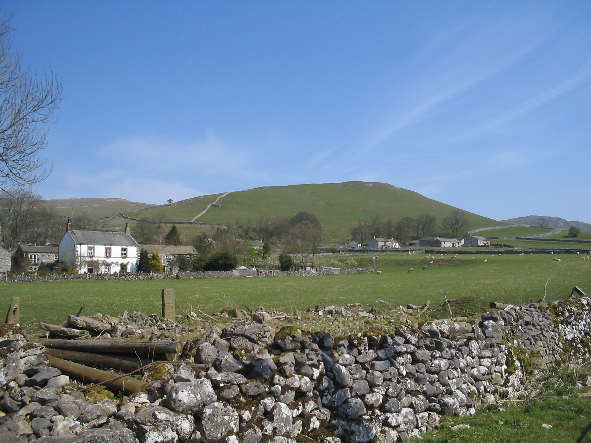
Malham is a small village, in the Pennines, at the southern base of the Yorkshire Dales. It's a pretty place, surrounded by limestone dry-stone walls, & with a stream running right through the middle of the village.
Mentioned in the Domesday book as 'Malgun', Malham has been a settlement for at least a thousand years. Traces of Iron age boundaries are still visible today. One hundred years ago, Malham was a place of mills and mines. Nowadays, hill farms and tourism are the main activities.
Malham is a popular walkers' destination. The rise in tourism over Malham's history has led to a barely-detectable deterioration of the area's surrounding paths as tourists wander off the paths and cause very slight, isolated pockets of erosion, a process often called "footpath erosion". The footpaths in the area are maintained by the Yorkshire Dales National Park Authority.
Leaving the car park we walk through the village and past the youth hostel onto a path that takes us to Malham Cove. (Where we may be lucky to see the Peregrines).
We join the Pennine Way crossing the Limestone pavement and continue to Malham Tarn.
Climbing away from the Tarn we head for Middle House farm in the N E direction then we go S past an old Roman fort to join Mastiles Lane. Here we head E towards Grassington before taking a path to Borderley Hall before climbing to Park House and the Weets. A little road walking takes us past the entrance to Gordale Scar and we will drop down to Janet’s Foss following the river back into Malham.
There are some short climbs on route. We encounter typical limestone country, lakes, moors and trees. On a wet day the limestone can be slippery, on a good day it is a pleasant walk.
B walk Malham about 8.5 miles and climbing around 700 feet
Our walk today takes us steadily uphill in Long Lane, a farm road, from where we get a good view of Malham Cove. We cross a minor road and continuing uphill across fields come in sight of Malham Tarn. Joining a minor road we walk Westward and then North to circle the Tarn before joining the Pennine Way and heading back towards Malham Cove. We leave it there to continue on fields, then join a minor road leading direct into town
There is regrettably some road walking on this route but there are no alternative footpaths around the Tarn. On the recce the underfoot conditions were dry and generally very good but there are about ten stiles to climb.
The walk is in famous limestone country around Malham, near Skipton in the South Dales. This 51/2 mile trail passes through meadow along a limestone gorge to the waterfall at Janet's Fosse, over rough fells with panoramic views and joins the Pennine Way footpath for the last half mile.
After Janet's Fosse there is a 3/4 mile steep climb( approx 200 metres ,600 Ft.) up to Weets Top but it is on a metalled road way, Hawthorne Lane, Then downhill over Hanlith Moor for spectacular views of the dale, Gordale Scar, Malham Cove and the surrounding craggy countryside, down to Hanlith where we pick up the Pennine Way back to Malham.
Clapper Bridge behind Malham
Dales Scenery
Janet's Foss
Marion out in front
Sheep with lamb
Which way now?
Monday, 12 April 2010
We had a glorious day on Saturday with sunshine, a full coach and three walks which all stretched our muscles just enough to prepare us for the rest of the season.
Conwy on the northern extremities of the Snowdonia National Park has been a popular venue for the club, last being visited in 2006 at the same time of the year, April.There is a variety of walks and 'after walk' interests in the town. for more information about Conwy click here
Conwy Castle dominates the town
The harbour in 2003, with sand, boats, shops and views
Steve waving to the photographer, while on Conwy Mountain and heading out on the B Walk
And where are they? I pray you tell."
She answered, "Seven are we;
And two of us at Conway (Conwy) dwell,
And two are gone to sea."
William Wordsworth, We Are Seven (1798)
Conway is a beautiful area for hill walking. This walk starts in front of ConwayCastle. The height of ConwayMountain is 809ft / 247m.The views from this mountain
are magnificent with its panoramic views inland and over the coast and estuary.
The maps required for this walk are: ORDANANCE SURVEY MAPS- Llandranger 115 (Snowdon) or Explorer OL17(Snowdon-Conwy)
Once you climb over the ladder-stile and enter the Conway Mountain Reserve, the beginning of this walk is fairly steep, however it levels out for you to enjoy a pleasant and comfortable walk. There are views West to Anglesey, South down the Conway valley and East to ClwydianMountains, on a clear day you may see gas rigs and wind turbines far offshore the North-East in LiverpoolBay. The best time to visit ConwayMountain is August-October where you can view the beautiful colours of the heathers on the mountain but April is still good. There is a wide stony path that runs along the ridge top through the remains of the Castell Caer Seion hill fort. The views around the mountain are breathtaking even before you reach the summit. Once we do reach the summit you can enjoy the panoramic views.
From the summit, we follow the path and head SW towards "PENSYCHNANT",Gwarchodfa nature and farm reserve. From the nature reserve we follow the path which takes us down to the SychanantPass / Bwlch Sychanant. We then cross the road and through the 5 bar gate heading South towards the ancient Church and Holy Well of Llangelynin.
This magnificent old Church is situated high above the Conwy valley in the shelter of Tal y Fan, it was founded in the 7th century with the spring of water in the corner of the churchyard once used for baptismal purposes, and its 16th century porch. There are still occasional services held here.
From the Church we walk around the rear to descend through deciduous woodland with occasional glimpses of the valley below and wind are way back to Conwy and the finish.
Although not a difficult walk, it is long and therefore a reasonable pace will need to be maintained to allow time for a brew at the finish.


.JPG)
.JPG)
.JPG)
.JPG)


.jpg)
.jpg)