Showing posts with label Malham. Show all posts

Monday, 10 May 2010

Malham Fell Club B Walk

Once again we were fortunate with the weather as it had been forecast rain, but instead we had a dry day with sunny periods, but with a cold NE wind. We had a big B Party and a good leader who kept the pace steady but within the reach of all. We headed towards Malham Cove and Tarn and had some spectacular scenery, typical of the Dales and an enjoyable day with some refreshments in Malham on our return

  • Distance: 8.5 miles 
  • Total ascent: 1080ft 
  • Time: 4hrs 50 mins
Click on picture to see all the photo's

Monday, 26 April 2010

A Walk from Malham

  • Leader: Jenny Matthias
  • Distance: 11.4miles
  • Total Ascent: 1827ft

Leaving the car park we walk through the village and past the youth hostel onto a path that takes us to Malham Cove. (Where we may be lucky to see the Peregrines).
 

We join the Pennine Way crossing the Limestone pavement and continue to Malham Tarn.


Climbing away from the Tarn we head for Middle House farm in the N E direction then we go S past an old Roman fort to join Mastiles Lane. Here we head E towards Grassington before taking a path to Borderley Hall before climbing to Park House and the Weets. A little road walking takes us past the entrance to Gordale Scar and we will drop down to Janet’s Foss following the river back into Malham.

There are some short climbs on route. We encounter typical limestone country, lakes, moors and trees. On a wet day the limestone can be slippery, on a good day it is a pleasant walk.

B Walk from Malham

Leader: George Mann
Distance: 8.5 miles approx
Total Ascent: 1200ft


click on map (and pictures) to enlarge.
B walk Malham about 8.5 miles and climbing around 700 feet


Our walk today takes us steadily uphill in Long Lane, a farm road, from where we get a good view of Malham Cove. We cross a minor road and continuing uphill across fields come in sight of Malham Tarn. Joining a minor road we walk Westward and then North to circle the Tarn before joining the Pennine Way and heading back towards Malham Cove. We leave it there to continue on fields, then join a minor road leading direct into town

There is regrettably some road walking on this route but there are no alternative footpaths around the Tarn. On the recce the underfoot conditions were dry and generally very good but there are about ten stiles to climb.
C Walk from Malham

Leader: Marion Young
Distance: 5.5 miles
Total Ascent: 869 ft


The walk is in famous limestone country around Malham, near Skipton in the South Dales. This 51/2 mile trail passes through meadow along a limestone gorge to the waterfall at Janet's Fosse, over rough fells with panoramic views and joins the Pennine Way footpath for the last half mile.

After Janet's Fosse there is a 3/4 mile steep climb( approx 200 metres ,600 Ft.) up to Weets Top but it is on a metalled road way, Hawthorne Lane, Then downhill over Hanlith Moor for spectacular views of the dale, Gordale Scar, Malham Cove and the surrounding craggy countryside, down to Hanlith where we pick up the Pennine Way back to Malham.


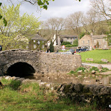
Clapper Bridge behind Malham
Dales Scenery
 Janet's Foss
Marion out in front
Sheep with lamb
Which way now?