Showing posts with label 2010. Show all posts

Saturday, 12 February 2011

Picture diary of the club walks in 2010

Club walks 2010
If the slide show does not start, move on by clicking left or right arrows.
View more presentations from htfellwalking.

Thursday, 6 January 2011

B Walk at Chipping

Saturday January 8th and afterwards at the Dog and Partridge


I deliberately left doing a recce till today[5th January] in view of the weather conditions we have been having and last years experience. The walking conditions were good, a bit of snow in evidence on the very edges of some of the country roads and the field paths as usual very soft and a bit wet and soggy but walkable.
          The walk will be similar to that I led two years ago but returning over the fields from Windy Hill Farm down to pass the old Chair Works and less than five miles.

For details of the walk, click on the link

Tuesday, 16 November 2010

Wednesday, 20 October 2010

November Walks Outing No. 315

Our next walking will be on
Saturday 13th November
and will be from 
Settle in North Yorkshire

Settle is a bustling market town in the foothills of the Pennines amongst some of the most picturesque scenery in North Yorkshire. The town stands beside the largest outcrop of limestone in Britain - in a region of scars, cliffs, caves and potholes. At the rear of the town a zigzag footpath leads to the summit of Castleberg crag offering a vantage point of the town in its dale and fell. Settle is a good base for exploring the Yorkshire Dales. 

The market place at Settle in the valley of the Ribble, is on the dividing line between the largest outcrop of limestone in Britain (to the North) and rolling gritstone moorland.

Explore the limestone country, and you are in a stark but spectacularly attractive area of pearl-white scars, potholes and caves.

Here too are Malham, Horton-in-Ribblesdale and the Three Peaks - Whernside, Ingleborough, Pen-y-ghent - each of which is served by good footpaths.

Limestone Pavement and Ingleborough - Where the limestone gives way to gritstone are grand waterfalls, which were joyfully visited by a young composer called Edward Elgar.

The moors, with their coverlet of peat and heather, are of the type known to the Bronte girls of Haworth. West of Settle is unspoilt Bowland, an Area of Outstanding Natural Beauty.

Settle has a full range of Tourist amenities. Giggleswick, just across the river being the home of Giggleswick School.

The Settle and Three Peaks area has justifiably been chosen as the backdrop for a number of film and television produtions.


There will be 3 walks;

Weather forecast for Settle

    Tuesday, 19 October 2010

    A Party Walk from Settle

    Walk Leader: Steve Edwards
    Distance: 11.3 Miles
    Total ascent: 1898ft


    Settle is a bustling market town in the foothills of the Pennines and boasts some of the most beautiful scenery in North Yorkshire. The town is beside the largest outcrop of limestone in Britain which is peppered with potholes, caves, scars and cliffs. Heading west, out of town, a footpath leads to the summit of Castleberg crag from which there is a fantastic view of the town and surrounding area.

    Settle is not really ‘A’ walking territory being just too far to reach one of the great Three Peaks to the North, so in true ‘A’ standard today’s walk will be more long than hard going.


    We initially have a very steep walk out of town climbing about 1100 ft in 30 – 45 minutes for stunning views of the area. We then have a long steady walk ascending 600 ft to our highest point of 1700ft. On a good day the views are stunning with Pen-y-ghent magnificent in the distance and rolling hills as far as the eye can see. The walking is easy under foot with very good roads /tracks to follow.
    On the way down we pass a large farm heading SW towards an oasis of trees which is hiding the beautiful Scaleber Force waterfall, certainly the jewel in the crown.

    Although not a difficult walk, it is long and therefore a good pace will need to be maintained to allow for a brew at the finish. We also need to be aware of the reduced daylight hours in November.

    To see this walk [with some modifications] in the reverse direction in March 2007 click here

    B Walk from Settle

    Walk Leader: Terry Simmons
    Distance: 8 ½ miles. moderate.
    Total Ascent/Descent: 1375ft


    Taken from “Country Walking magazine”.

    This is the first time I have tackled a “B” walk as leader and the word that comes to mind for this is particular walk is “challenging” but with reasonable weather very gratifying.

    It is a steady climb for the main part, which also has a little of this after lunch. the walk commences from the centre of town, travelling south we head for Cleatop Woods then across fields through green lanes and after crossing the Settle - Malham road we pass beneath Warrendale Knots and Attermire Scar. 


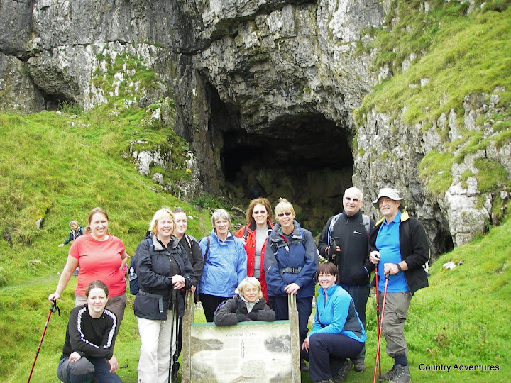
    As we approach Victoria Caves [which is just above us to the right], we find we are on our descent and enjoying excellent views of Langcliffe and Settle below on the left as we make our way through kissing gates and fields to our destination for a well earned beverage possibly in the “Naked Man CafĂ©“.. 


    C Walk at Settle

    Walk Leader: George Mann
    Distance: about 6 miles
    Total ascent: 570 ft
    Proposed route

    Starting from the main street we pass through an older part of Settle down to a footbridge and join the Ribble Way. This we follow all the way in places very close to the river until we arrive at Stainforth Force, a section of the river with rapids and falls. Here with luck we shall glimpse a salmon as they head up river to spawn. We then do a bit of minor road walking up through Little Stainforth village before leaving the road to cross fields climbing gently to Hanging Scar with a good view of Reinsber Scar (a limestone outcrop ) then above Stackhouse before making our way on a field path adjacent to the road as we return to Settle.
      above Stackhouse

    Although this not a long walk there are about a dozen stiles, ( none too difficult to us walkers ) but with a party can be time consuming, however by giving assistance to others this can be kept to a minimum.  

    The recce carried out following a days heavy rain and whilst the fields were soft and some areas muddy walking condition good.


     Stainforth Bridge

     Stainforth Force

    Monday, 11 October 2010

    Tuesday, 5 October 2010

    Coniston Weather

    Monday, 20 September 2010

    October Walks Outing No. 314

    Our next walking will be on
    Saturday 9th October
    and will be from 
    Coniston in Cumbria
    we last visited Coniston in May 2007
     Furness Fell looking across the bowling green and the tennis court.
    Looking along the lake
    Quite a few years ago at the top!
    The vast bulk of Coniston Old Man dominates Coniston village. Its flanks are scarred by huge slate quarries, two currently being worked. The combination of scenic grandeur with Victorian prosperity brought several eminent characters to Coniston. John Ruskin, the artist, writer and social reformer, lived at Brantwood, with its superlative views of the Old Man. His neighbour the historian Collingwood had four grandchildren who were taught to sail on Coniston Water by Arthur Ransome, inspiring the writing of Swallows and Amazons. While the Old Man is an objective of pilgrimage for most fit visitors to Coniston, there are numerous walks at all levels to thrill and excite walkers of all levels of fitness.

    There will be 3 walks;

    Sunday, 19 September 2010

    A Party Walk from Coniston

    Walk Leader: Tommy Ryder
    Total Distance: 9 mls approx
    Total Ascent/Descent:3000ft


    Proposed route
    Starting with our first part of the walk from Coniston the walk passes the slate quarries and heads towards the higher ground of Coniston old man. The summit looks over the most fantastic views even showing the English coastal positions. The walk is a little less strenuous than walking directly towards the Old Man of Coniston, However this is not an easy walk and at times can be quite challenging, in that an obvious accent to the summit will be more gradual but steep. The sensible advice of warm and waterproof clothing and walking boot/shoes is strongly advised with packed lunch for a stop at a pleasant strategic position.


    Leaving from Coniston by the tourist information centre we pass the road at the side of the Black bull pub ( Not Walton vale Liverpool!) and via right up to the YCA house. Keeping the house on the right and Levers water reservior on the left, Follow the track to Swirl House, and then turn and head for the summit of Coniston. Keeping Levers water on the left and low water head down past disused quarries, This is the winding track back to Coniston 

    Guess where this is!


    B Walk from Coniston


    Walk Leader: John Hanney
    Total Distance: 7 mls
    Total Ascent/Descent:1270ft

    B Party route to Tarn Hows
     
    The walk to Tarn Hows includes part of the Cumbria Way and soon reaches a renovated stone building which houses information boards. A steady climb through Back Guards plantation and Tarn Hows wood, andwith kissing gates, affords romantic opportunities. Tarn Hows cottage is passed before reaching the highest point overlooking Tarn Hows. 

    Tarn Hows
    The undulating anticlockwise walk round the tarn is about 1 ½ miles. From the tarn outflow, the path down Tom Gill follows a series of waterfalls and the path is rocky, tree rooted and steep in places. 

    Tom Ghyl Falls after recent heavy rain


    A short main road walk to Yew Tree Farm leads to the footpath back to Coniston. The height climbed is 880 ft.

    Tarn Hows reflections

    C Walk from Coniston

    Walk Leader: Les Gibson
    Total Distance: 6.5 mls
    Total Ascent/Descent: 400ft

    C Party Route - Click to enlarge
     
    This 6.5 mile walk has lots of variety, beautiful lakeside walking, accompanied by some fantastic scenery, giving many photographic opportunities.


    Approaching the lake at the start of the walk
    We start by walking from the car park down to the lakeside to enjoy our morning coffee/tea and toasted teacakes etc. ( there are toilets in the car park and the cafe by the lakeside ) while at the cafe, enjoy the atmosphere of the steam boats, yachts, and small motor launches going to and from the jetties.

    Sunny Bank Jetty
    A Nice view point

    After leaving the cafe we walk along the lakeside with some breathtaking scenery, passing Coniston Hall, continuing on to Torver-Common wood, where we make a steady climb past Brackenbarrow farm, through a lovely wooded area to an old defunct railway line making our way back to Coniston, again taking in the scenery from a higher level.
    There are no stiles, only 'kissing' type gates, all easy to pass through.

    Through the woods alongside the lake


    Saturday, 21 August 2010

    Our next walking will be on
    Saturday 11th September
    and will be from 
    Ambleside, Cumbria


    Ambleside, at the head of Windermere and the foot of the
    Kirkstone Pass, lies in the very heart of the Lake District,
    with easy access to Grasmere, Keswick, Windermere
    and the Langdales. A vibrant, busy town, surrounded
    by magnificent Lakeland fells, it is the ideal location for
    a rural break. Although Ambleside has its roots in the
    medieval woollen trade, it is predominantly a Victorian
    town, built of dark grey slate.

    Ambleside’s history reaches back at least as far as Roman
    times. At nearby Waterhead the Romans built a stone fort on
    a trade route through South Lakeland (now in Borrans Field).
    Medieval Ambleside had a thriving woollen industry centred on
    the fast flowing Stock Ghyll which powered the fulling mills
    that pounded the newly woven cloth. When the town was
    granted a market charter in 1650, the Market Place became the
    commercial centre for agriculture and the wool trade. The 17th
    and 18th centuries were a major period of rebuilding, initiated by
    yeoman farmers and landowners made wealthy by the profits of
    the woollen trade. Many houses date from this period, notably
    at the pretty village of Troutbeck nearby. One particularly fine
    example, Townend 1 , is owned by the National Trust (open
    March–October).

    The iconic Bridge House 2 is a tiny house over Stock Beck
    in the centre of the town and one of the most photographed
    buildings in the Lake District. Originally built as an apple store
    by the Braithwaites of Ambleside Hall in 1723, the building is
    now owned by the National Trust and is open daily from Easter
    to October.

    As a gateway to the spectacular Langdale Valley, Ambleside is
    deservedly popular, both with leisure visitors wanting a relaxing
    break and outdoor enthusiasts looking for a challenge. The town
    offers easy access to a range of water sports, walks, climbs
    and cycle routes, and has plenty of great pubs and cafés. It
    also has a wonderful literary and artistic heritage, which can be
    explored in the town’s galleries and museum.

    Ambleside’s specialist retailers offer everything from outdoor
    clothing to interior design. Other shops specialise in unique pieces
    inspired by the landscape, including slate ornaments, watercolour
    paintings and pottery – look out for the Made in Cumbria logo,
    which shows you are supporting local craftspeople.

    We last visited Ambleside in September 2007

    There will be three walks;

    A Walk at Ambleside

    Walk Leader: Jenny Mathias
    Total Distance: 9 mls
    Total Ascent/Descent: 2700ft


    The walk out of Ambleside is a steady climb to the summit of Red Screes at 2546ft. We start gently at first following Scandale Beck to its source just under Red Screes. If we get a clear day the views are spectacular all the way around. (On the recce we saw many of the fells and lakes.)


    The climb down follows a ridge and for the most part it is a steady downhill path! We come out onto the Kirkstone Pass Road. It is a lovely walk but a good pace will be neede to ensure time for a cup of tea at the end.


    More photographs taken by a member on this walk in February 2008

    Friday, 20 August 2010

    B Walk at Ambleside

    Walk Leader: Keith Scott
    Total Distance: 9 miles
    Total Ascent/Descent: 1000ft

    click on map/pictures to enlarge

    A scenic route around both Rydal Water and Grasmere involving a few gentle gradients. The route covers walking along public roads at times and some rough surfaces, but with very little mud hopefully!


    We pass some interesting sites, including Dove Cottage, Wordsworth's home for some time, Rydal Mount, where he lived almost half his lifetime and St Oswalds Church, Grasmere where Wordsworth is buried.


    Much of Lakeland has changed since Wordsworth's time to destroy the rural peace of this Lakeland valley, however this walk, at least in parts, helps to recapture the sense of that more tranquil past.

    C Walk at Ambleside

    Walk Leader: Joan Hilton and Shirley Fairnie
    Total Distance: 5/6 miles
    Total Ascent/Descent: 900ft approx


    click on pictures and map to enlarge

    When Shirley and I recce'd this walk it was a glorious day and the views were stunning and well worth the ½ mile ascent and there is plenty of time to take in the scenery and there are no stiles!!


    The path then becomes a pleasant track as it makes its undulating way to High Sweden Bridge. 


    Our lunch stop here is beside the babbling stream with the parapet-less bridge spanning Scandale Beck. 


    The gradual descent takes us back to Ambleside and a chance to visit this charming old Market Town and sample some of the gastronomic delights.

    Sweden Bridge acquired its name from the nearby Sweden Crag and in this instance is derived from an old Norse word Svfthinn meaning ‘land cleared by burning’