Distance: 9 miles
Total Ascent/descent: 2300ft
 |
| click to enlarge |
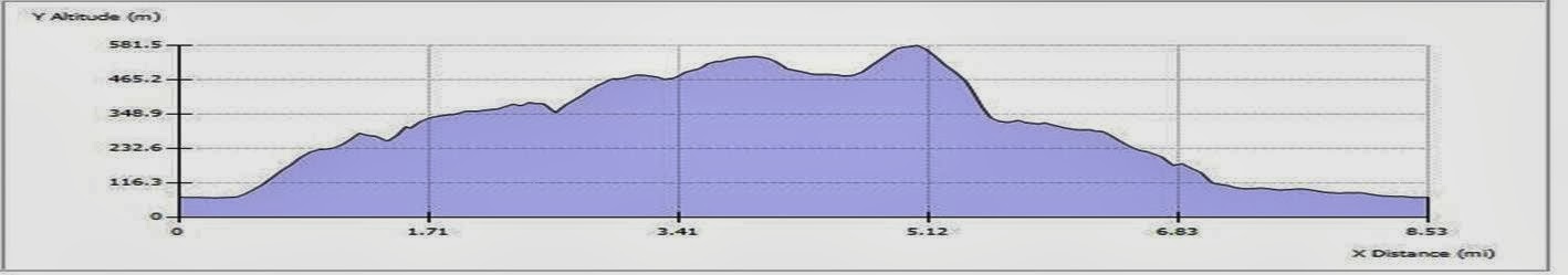 |
| elevation profile |
If the weather is good, this walk will present the very best the area has to offer: beautiful views of Grasmere and Windemere—from a height—the archetypal valley view of Langdale Fell plus several tarns and waterfalls.


We leave Grasmere to the west for a reasonably easy but steady climb up along the flank of Silver How which eventually offers great views of both Grasmere and Windemere lakes. We then strike north on a gradual climb to the Lang and Castle Hows via Raw Pike. This section is easy going but could be quite bleak yet at one point there is an outstanding vantage point of the whole length of Langdale Fell towards Scafell Pike. The path along Blea Rigg is a little ill-defined in places but, time permitting as we need to uphold a good pace, we shall divert westwards down to Stickle Tarn for lunch [halfway].

 Retracing steps to Blea Rigg, possibly via a roughish climb, we then join a main artery down past Belles Knot, the beautiful Easedale tarn and the spectacular Sour Milk Gill waterfall. If wet on this stony path, sticks will be invaluable. The final section into Grasmere is easy-going and very scenic.
The 9-ish mile walk profile lives up to the ‘A’ standard and if a good pace is maintained there will be time to admire the outstanding scenery as well as enjoy the taste of a relaxing drink at the end.
An elevation profile from a min of 67m to 581m will provide you with a good leg-stretch!!!
No comments:
Post a Comment