Monday, 12 September 2011

Photographs taken on the three walks at Bakewell


VIEW B WALK SLIDE SHOW 1


VIEW B WALK  SLIDE SHOW 2


Saturday, 3 September 2011

September Walks from Bakewell

September Walks from Bakewell

and will take place on

Saturday 10th September 2011
0800hrs prompt from short stay car park in the village
We last visited Bakewell in August 2009 on a beautiful warm sunny day and all have fond memories of three great walks. We do hope that you will enjoy the choices of our 3 walk leaders this time round

Walk Leaders
[click on name to view walk details]


Bakewell in Derbyshire and the Peak District , is a beautiful, small, market town situated on the River Wye which is crossed by a 13th century 5 arched bridge still open to traffic. The bridge had been widened in the 19th century.
Bakewell was mentioned in the Domesday book as having a church and 2 priests signifying its importance even then. In 1502 Bakewell was owned by the Vernon family and passed on to the Manners family in 1567 when Dorothy Vernon married John Manners. Their son, Sir George Manners married Grace Pierrepont who in 1637 founded the grammer school, Lady Manners School. Monuments to the Vernon family can be found in the All Saints Parish Church which stands in a commanding position on the hillside where the town started.
The Rutland Arms Hotel in the centre of Bakewell replaced the White Horse Inn, which together with some other buildings was demolished in 1805 to form Rutland Square. It was built to cater for coach travellers and in 1818 as many as 600 travellers passed through the town. The Hotel has a literary connection in that Jane Austin is reputed to have stayed at the hotel whilst writing Pride and Predudice. Bakewell has been identified as Lambton.
The famous Bakewell pudding was also invented accidentally at the Hotel, when a cook misinterpreted instructions and poured egg mixture over the jam instead of mixing it in the pastry and what should have been a tart was now a pudding. Bakewell puddings can be bought at several shops in the town centre.
For more information about Bakewell, click here;
Weather forecast for Bakewell, click here;

Friday, 2 September 2011

A Walk from Bakewell

Walk Leader: Steve Edwards
Distance: 10 miles
Total Ascent: 1200 ft,  Descent: about 1700ft


This is a fairly easy A walk, more like a B+. The walk starts from the Wyedale car park which is just off the A6 between Buxton and Bakewell,so be prepared to leave the bus early. We walk through the valley of Deepdale rising rapidly as we head for the small village of Monyash once the centre of lead mining. From now on it is almost all descent heading for the beautiful Lathkill Dale, once a mining centre but now a tranquil valley with clear water and rare wild life. At the ancient village of Conksbury [now archeology as there are no dwellings left!] just after the spectacular series of weirs we head over the fields to Haddon House and the coach park at Bakewell.
A Walk Route


Moneyash Village Green
Batemans House. The minekeepers house built over a secret type of water pump to drain the mine
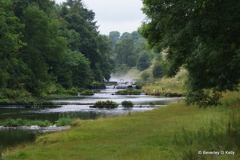
Between Conksbury and Over Haddon the Lathkill flows over a series of weirs, probably designed to hold back the waters for the mills, but it makes a lovely walk

B Walk at Bakewell

Walk Leader: George Mann
Distance: 8.5 Miles app
Total Ascent/Descent: 1025ft
approximate route, subject to alteration
Our walk today takes us initially alongside the River Wye before passing through a housing estate then up past the cemetery on our way towards Norton Barn Farm and the Village of Over Haddon. 

From there we cross over a series of fields heading for the village of Sheldon. We stop on the way to have a look around the  preserved buildings of the Magpie Mine one of the few reminders of the extensive lead and fluorspar mining that took place in the Peak District.
The Magpie Mine

Skirting the lower end of Sheldon we proceed downhill to Sheepwash Bridge in the village of Ashford in the Water and from there partially alongside the river our path leads us back to Bakewell. 
Looking towards Bakewell after Sheldon

There are about twenty stiles to negotiate the majority fairly easy  

C Walk at Bakewell

Walk Leader: Norman Jones
Distance: 6 miles app
Total Ascent/descent: 830ft
Height Gain about 500ft

The walk includes undulating parkland and woods, it's 6 miles long with a height gain of 500ft. Generally good underfoot.


We leave Bakewell in a south-easterly direction on a minor road and go under a bridge which is the southern end of the Monsal Trail. The road becomes a track, rising gently through undulating countryside and turning onto a woodland path. This rises steeply for about 400 yards, then becomes a flatter woodland route before reaching Carlton Pastures an ara of open parkland which soon slopes downwards. 


We continue on this parkland, which borders the Duke of Devonshire's Chatsworth Estate, for about a mile to join the Bakewell/Edensor minor road. This is our steep downhill route back into the centre of Bakewell for refreshments.

Saturday, 13 August 2011

August Walks from Ingleton on the Edge of the Yorkshire Dales

and will take place on

Saturday 13th August 2011
0800hrs prompt from short stay car park in the village

The limestone scenery of the Ingleton area
The village of Ingleton is surrounded by magnificent countryside with caves, waterfalls, and mountains. The Craven Fault crosses the area, and geological and archaeological sites abound.

Local attractions include:
  • The underground world of White Scar Cave, Britain's longest show cave
  • The Waterfalls Walk through woodland gorges with spectacular waterfalls (below)
  • Limestone peaks and scenery, with a direct route for the ascent of Ingleborough (above)
  • The nearby Settle-Carlisle railway and the famous Ribblehead viaduct
Ingleton has a wide range of accommodation, and is well placed for visiting the Yorkshire Dales, the Lake District, and the coast at Morecambe and Blackpool.
The A65 Leeds-Lakes road now by-passes Ingleton, which is only 16 miles from Hawes in Wensleydale and a similar distance to Lancaster.
Ingleton lies on one of the principal East-West routes across the Pennines used from prehistoric and Roman times. The remains of an Iron Age fort can be seen on the summit plateau of Ingleborough, at 723 metres (2372 feet), the best known of Yorkshire's Three Peaks. The ascent is by a relatively easy path from the village.


There will be three walks as normal.

 Walk Leaders