Monday, 14 May 2018

B Walk from Betws-y-Coed 2018

Walk Leader: Gwyn Jones
Walk Distance: 8.7 miles app
Total Ascent/descent:  1600ft


A part repeat of a linear walk I led a few years ago. We depart the coach at Llanrwst and after a toilet stop we make our way along level ground for approx.1 mile to Trefriw. From here we climb steadily up to Llyn Geirionydd. We continue to climb gently enjoying views over the lake. As we ascend we begin to obtain views towards Snowdon (weather permitting). Shortly we begin our descent back to Betws-y-Coed. There are a number of ascents and ups and downs but nothing too severe. There will be plenty of stops for a puff (for me if not for you).   

C Walk from Betws-y-Coed 2018

Walk Leader: Patrick Parkes
Walk Distance: 4 Miles app
Total Ascent/Descent: 300ft


The walk will be a “figure of eight walk” based on Betwys y Coed.

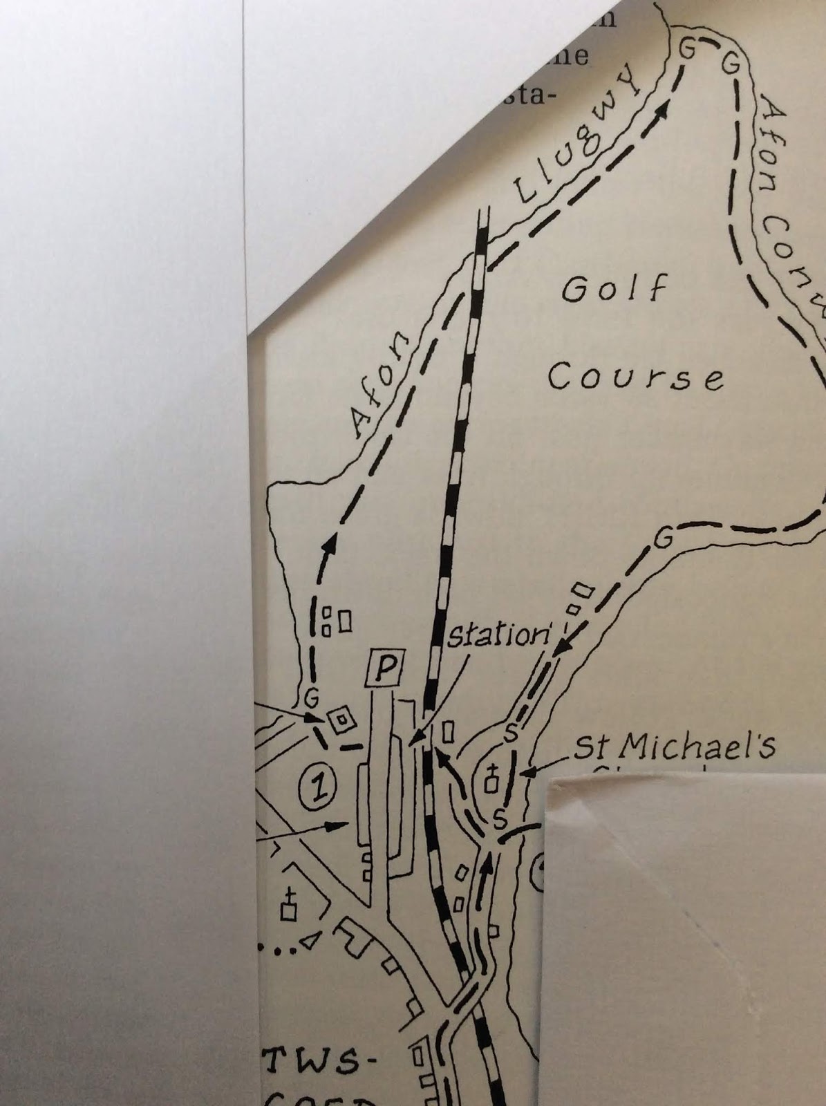
The first loop of 1.5 miles is easy walking along river banks coming back to Betwys near to the railway station. It may be that anyone on the bus not originally intending to do a walk might like to join us on this first loop.

The second loop stars also as a riverside walk. Initially it is easy walking but the path then becomes less distinct, crossed by a number of large tree roots and it then becomes quite rocky. At Miners Bridge, which is a very distinctive and interesting landmark the path follows a steep but comparatively short climb to a minor country lane which winds back to our starting point.

Saturday, 5 May 2018

388 Walks from Glenridding 2018

Our next walk of the 2018 season will be from

Glenridding

in Cumbria
on

Saturday 12th May 2018

0800hrs prompt from the Short Stay Car Park

Glenridding is a village at the southern end of Ullswater, in the English Lake District. It suffered badly in the floods a couple of years ago but has determinedly recovered and catering for it's tourists. The village is popular with mountain walkers who can scale England's third-highest mountain, Helvellyn, and many other challenging peaks from there.

There will be Three walks;
  • A Walk led by: Garth Raybould
  • B Walk led by: Jennifer Mathias
  • C Walk led by: Gwyn Jones
Details will be added as they become available, but by Saturday 5th May

'A' Walk from Glenridding 2018

Walk Leader: Garth Raybould
Distance:  8 miles app
Total ascent: 2600ft
A Route (clockwise)
 This is Britain’s No. 1 walk (according to Trail magazine) – Helvellyn via Striding Edge. I know we did this on our last visit to Glenridding but (a) I wasn’t on that walk and (b) it’s been specially requested! We start off up the right bank of Glenridding Beck (don’t anybody try to tell me it’s the left bank) and after a few hundred metres start to climb up Little Cove, topping out on Birkhouse Moor. This section is quite steep, mainly up irregular steps of rock, but we don’t need to rush it. From Birkhouse Moor we follow a gradually ascending path to Hole-in-the-Wall, Bleaberry Crag and eventually the excitement that is Striding Edge. Ultimate care is needed here but there are alternative paths for those who don’t want to walk the knife-edge. Then there is the final rock scramble leading to a grassy walk to the summit. From here there is an easy descent and short ascent to Whiteside Bank, then the main descent across Glenridding Common and into Glenridding itself. Total distance about 13 km (8 miles); total climbing about 800 m (2600 ft).
 

'B' Walk from Glenridding 2018

Walk Leader: Jennifer Mathias
Total Distance: 6.5 Miles app
Total Ascent: 1600ft app
B route anticlockwise


Although this walk is only about six and a half miles it is an interesting and somewhat challenging walk. There will be enough time to take in fantastic views as well as take the the ups and downs steadily.


Leaving the car park (where there are the only toilets on the walk and they are 30p!) we will cross the road and take ‘The Lake’ path North for about a mile. Crossing the road we take a farm track as it gradually winds up through woods to Seldom Seen. We will look down on picturesque Glencoyne Farm, notice the chimneys and white rough cast walls. The Seldom Seen cottages were built for lead mine workers (well away from the fleshpots of Glenriding).


 As we climb the fell slopes of Sheffield Pike 2215’ (not for us today) we can look back down the Glencoyne Valley at glorious views of Ullswater and maybe the Pennines Cross Fell.

We continue to climb to Sticks Pass then we will begin our descent through the remains of the most successful lead mines in England. It was used in 1959 the test instruments for detecting atomic explosions. We must take care through the steepest part a zig-zag path through the debris.

Glenridding comes into view then we turn uphill towards Red Tarn and Helvellyn, sorry to disappoint you we are leaving the mountain to the A party, to find the bridge and make our way back into the town following Glenridding Beck and well earned refreshment.


'C' Walk from Glenridding 2018

Walk Leader: Gwyn Jones
Total Distance: 6.5 Miles
Total ascent:  

This walk is about as flat as you can get in the Glenridding area. There are ups and downs but all very gentle. In general it is an easy walk. There are no stiles. We head south to Hartsop – have our lunch at Cow bridge - then return to Glenridding. Paths are generally very good and dry.


Sunday, 15 April 2018